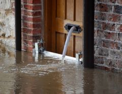
Flood - Recorded Outline of Historical Events (EA)
The Historic Flood Map merges together all the individual flood outlines from rivers, the sea and groundwater springs, so that at any given location there is only one polygon covering it, even if the location has flooded multiple times.
It therefore reflects the maximum extent of all the flood outlines on record, rather than any individual flood outline. These Environment Agency flood outlines cover England and Wales.
Supply format: Shape file / Tab / GML and other
Data availability: Available under the Open Government Licence (OGL).
Other conditions may apply and these are available via the download site.
Charge: No charge.
Sample available: Data can be downloaded immediately.


 The Water Security Knowledge Exchange Portal supports the objectives of the