


How can the risks of groundwater flooding be reduced?
The challenge
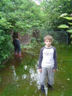
An estimated 1.6 million properties are at risk of groundwater flooding in England and Wales, and the resulting expense to people and businesses can be very significant.
Following the EU Floods Directive in 2008, an assessment of the risk of groundwater flood risk is now a legal requirement across the UK.
The Environment Agency and local authorities need improved groundwater flood risk maps and datasets to prepare local flood risk assessments and management strategies.
The solution
 National datasets developed by the British Geological Survey (BGS) show where groundwater flooding could occur, and identify where further investigation is needed to assess risks to property or infrastructure. These datasets have proved highly useful for local authorities and developers, and are a component of homebuyer reports that identify the potential for geohazards to affect individual properties.
These datasets now form the basis of maps issued by the Environment Agency (EA), and used by Lead Local Flood Authorities to help produce the preliminary groundwater flood risk assessments required by EU flood regulations.
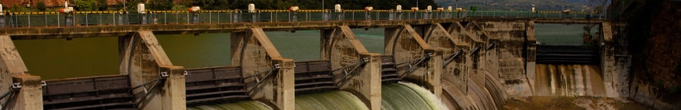
In collaboration with the EA, BGS has investigated the causes of groundwater flooding in the River Thames floodplain within the city of Oxford, and helped the EA and Oxford City Council in developing a flood management strategy for the city. In Scotland, BGS has worked with Moray Council, undertaking a series of groundwater investigations to ensure that a proposed £30m flood prevention scheme was fit for purpose. Past and ongoing BGS research also focusses on understanding those areas of the south and east of England underlain by Chalk rocks, where the greatest risk from groundwater flooding occurs. Computer models have been developed to improve flood risk assessment.
Resulting benefits
Consultants DTZ have independently estimated that through the provision of better quality information, the BGS groundwater flood susceptibility maps could result in national savings amounting to £71-284m over a 20-year period.
Specifically, the findings from the BGS work in Oxford project have had a direct benefit to Environment Agency objectives in protecting the city from flooding, while the recommendations made by BGS have been incorporated into the final Forres flood alleviation scheme.
Future directions
Groundwater flood susceptibility is an emerging area of science. Further research is needed to enable location-specific groundwater flooding risks to be mapped with increased degrees of confidence. Interactions between groundwater and the built environment, e.g. building foundations and drainage systems, also need to be investigated.
Add Pingback