

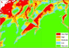
Susceptibility to Groundwater Flooding Maps (BGS)
The British Geological Survey produced national hazard dataset for groundwater flooding for Great Britain at a scale of 1:50 000. Based on geological and hydrogeological information, the digital data can be used to identify areas where geological conditions could enable groundwater flooding to occur and where groundwater may come close to the ground surface.
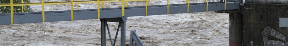
Groundwater flooding is the emergence of groundwater at the ground surface. It can occur in a variety of geological settings including valleys in areas underlain by Chalk, and in river valleys with thick deposits of alluvium and river gravels. Groundwater flooding happens in response to a combination of already high groundwater levels (usually during mid- or late-winter) and intense or unusually lengthy storm events. Groundwater flooding often lasts much longer than flooding caused by a river over-flowing its banks. It may last many months and can cause significant social and economic disruption to the affected areas.
Supply format: GIS polygon data. (ESRI, MapInfo, others available by request)
Data availability: Subject to licence fee and data preparation fee.
Charge: Subject to licence fee and data preparation fee. 30p per km2 as of June 2014.
Sample available: Download

 The Water Security Knowledge Exchange Portal supports the objectives of the